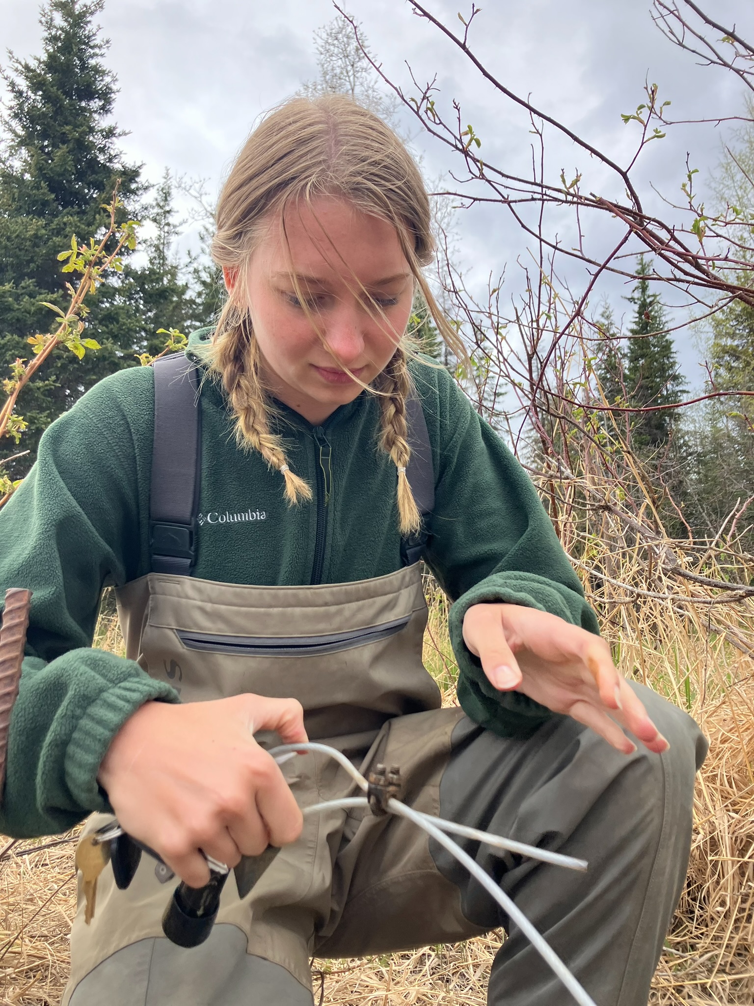
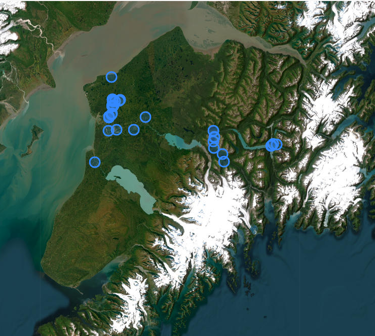
Fresh data now available on the AKTEMP Water Temperature Database!
March 31, 2026Interested to see the daily temperature fluctuations of a stream near you? The Kenai Watershed Forum maintains 20 water temperature logger sites across our local stream networks. These temperature loggers record every 15 minutes, all year long! New water temperature data for the Central Kenai Peninsula has just been uploaded and is now available on the AKTEMP Water Temperature Database.
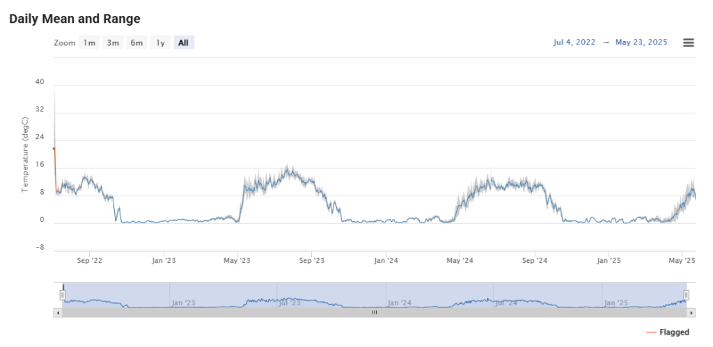
Temperature loggers help scientists, resource managers, and community members better understand stream health, salmon habitat conditions, and how local waterways respond to seasonal and long-term environmental changes.
Whether you’re a researcher, angler, educator, or simply curious about local waters, you can now explore the latest temperature records and see how streams across the region are changing.
View the updated data and learn more at the University of Alaska Center for Conservation Sciences’ AKTEMP Website.
A huge thanks to the USGS Climate Action Science Center, Alaska Sustainable Salmon Fund, University of Alaska Center for Conservation Sciences, Cook Inletkeeper, and many others for supporting this ongoing work. Open data like this helps support informed stewardship of our rivers and salmon habitat. Take a look and dive into the numbers!
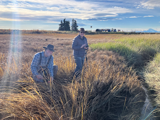
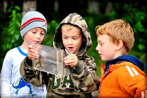
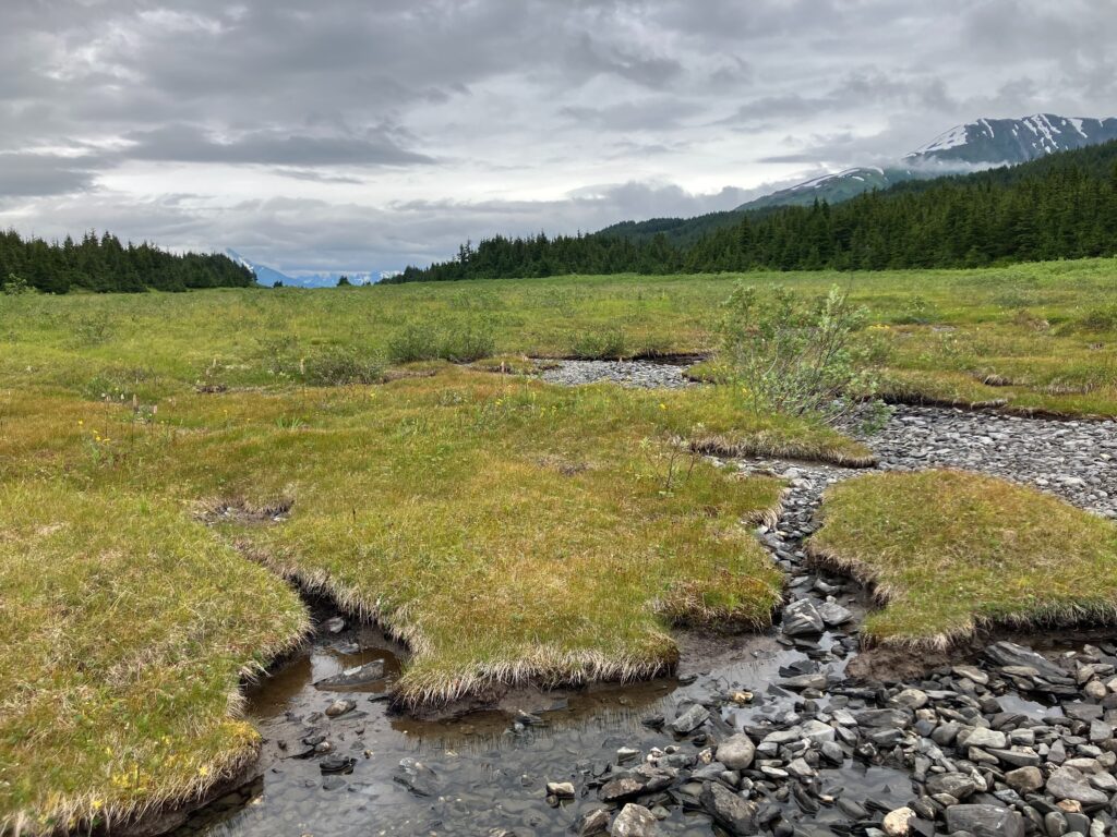
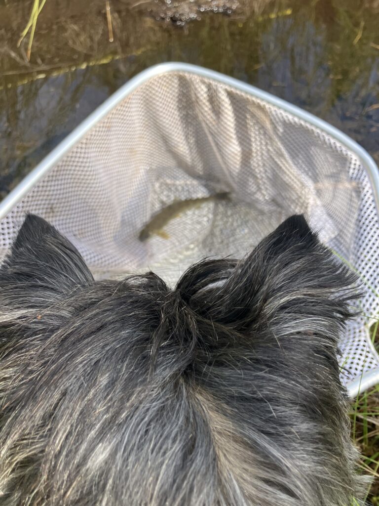
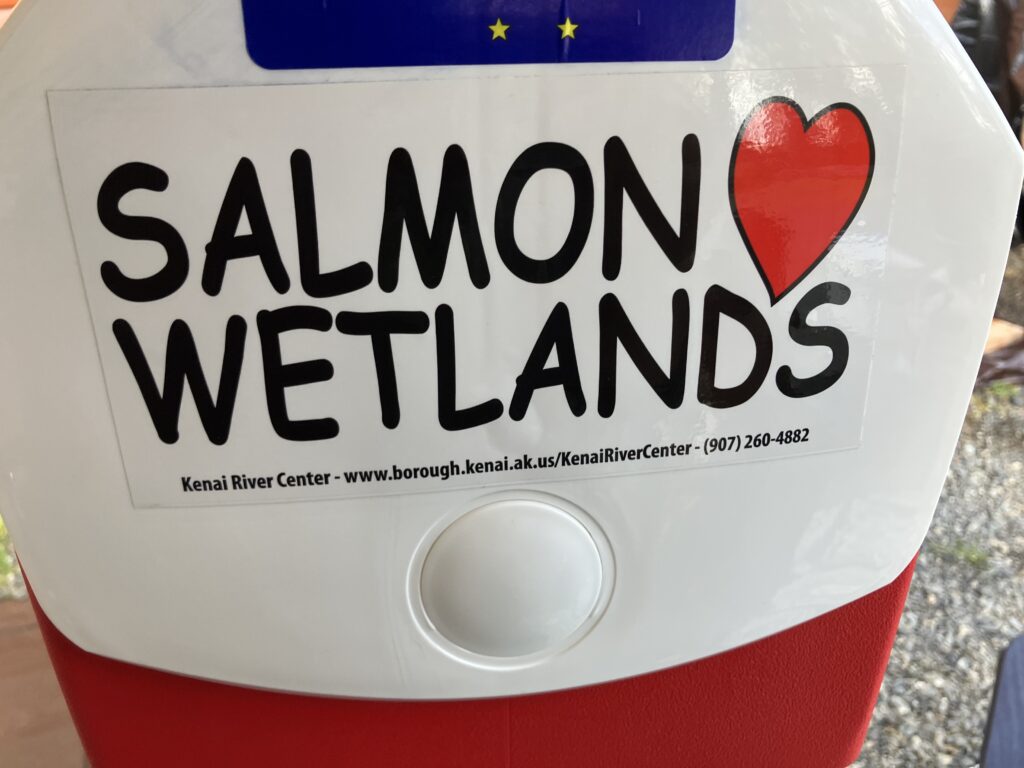
Wetlands in our Backyards
March 18, 2026Kenai Watershed Forum volunteers study fish habitat in wetlands near City of Kenai Docks.
With spring right around the corner, some might find themselves asking “where will all the snowmelt go?” To this we answer; Wetlands!
Wetlands are some of the most vital–and often overlooked–ecosystems on the Kenai Peninsula. From filtering water and reducing flood risk after a winter full of heavy snow loads, to providing essential habitat to wild salmon, birds, and other wildlife – wetlands support the health of our entire region’s watershed.
Dr. Mike Gracz, a previous Kenai Watershed Forum scientist led research between 2005-2015 that culminated in the creation of a high-resolution GIS map supported by extensive field data, and you can find this map on the Kenai Peninsula Borough’s KPB GeoHub, under ViewKPB.
You can find a lot more resources and details about wetlands on the Kenai Watershed Forum’s page on Cook Inlet Wetlands. The Kenai Watershed Forum is also applying for grant funding at this time to continue building community capacity–helping residents, local leaders, and partners better understand, appreciate, and conserve wetlands.These efforts will be key in ensuring future generations can benefit from healthy, functioning, intact ecosystems.
Want to learn more about how you can partner with us and support our Kenai Peninsula Wetlands? Check out our Cook Inlet Wetlands page on our website, and contact alie@kenaiwatershed.org.
Fish Habitat Mapping Community Subawards – Application Period Open from January 5th – April 4th, 2026
January 5, 2026Got an idea for a project to help support local freshwater fish habitat conservation? We have funding for you to make it happen!
- Access the Request for Proposals (RFP) here: Download Community Subawards RFP 2026
- Submit your application using the Google Form linked here: Fish Habitat Mapping Community Subawards – Application Form
The Kenai Peninsula Borough is home to tens of thousands of miles of rivers, streams, and lakes, which are home to millions of wild fish. However, only a portion of these waters have been fully mapped and surveyed to document fish habitat, a critical step for responsible management and conservation. Kenai Watershed Forum and other local organizations are working to fill this gap with innovative research; read more on our blog at https://www.kenaiwatershed.org/news-media/fish-habitat-mapping-2025/.
We need the community’s help to help make this work happen. There are several fun ways to get involved, including signing up for our Stream Watch program or getting involved with Cook Inletkeeper’s Backyard Salmonscapes program.
If you have an idea to support this work that could use funding support, we have financial support available. Four (4) awards of up to $2,500 each, will be distributed to support innovative, community-based projects that improve conservation, mapping, or outreach associated with freshwater fish habitat within the Kenai Peninsula Borough.
Project ideas include, but are not limited to:
- Covering expenses for fieldwork (travel costs, equipment purchases, etc)
- Purchase of outreach materials (e.g. more “Baby Salmon Live Here” signs)
- Covering expenses for an invited speaker for a public event
- Hosting an educational or outreach events
What’s your idea? We’d love to hear from you and help bring your idea to life. For questions, reach out to ben@kenaiwatershed.org or bookeeper@kenaiwatershed.org.
Thanks, and we can’t wait to hear from you!
– Benjamin Meyer, Research Coordinator
Kenai Watershed Forum Announces $15,000 in Environmental Education Sub-Grants

Applications Now Open for Adopt-A-Stream Programming Partnerships
Thanks to support from the Environmental Protection Agency (EPA), we’re offering approximately $15,000 in sub-grants to bring hands-on watershed education to K-12 students through our acclaimed Adopt-A-Stream program.
Access the Request for Proposal (RFP) here: Download Adopt-A-Stream Subaward RFP 2026
Submit your application using the Google Form linked here: EPA Adopt-A-Stream Subawards – Application Form
We’re seeking three partner organizations to receive approximately $5,000 each to design and deliver engaging environmental education projects that connect students with their local streams and watersheds. For over ten years, our Adopt-A-Stream program has transformed how Kenai Peninsula students understand and protect their environment through interactive classroom visits, field trips, and our popular summer camp. Now we want to expand this impact across the Peninsula with your help!
Your project can incorporate exciting Adopt-A-Stream components, such as salmon life cycles, macroinvertebrates, stream ecology, ecosystem management, and water quality monitoring. Whether you’re planning classroom activities, field investigations, or outdoor learning experiences, we’re looking for creative approaches that foster environmental stewardship and literacy in young Alaskans.
Eligible applicants include 501(c)(3) nonprofit organizations, local education agencies (such as KPBSD schools), and environmental agencies located within the Kenai Peninsula Borough. Selected partners will receive support from KWF staff in completing bi-annual and final reports, making the administrative side manageable so you can focus on inspiring the next generation of watershed stewards.
Ready to bring watershed education to life for your students? We can’t wait to see your ideas for engaging young people with the streams and ecosystems right in their backyard.
Interested? Please submit your application via this Google Form, and let’s work together to create a generation of informed environmental stewards on the Kenai Peninsula!
For any questions regarding this project, please contact KWF’s Education Specialist, Brandon Gustafson, at (brandonedu@kenaiwatershed.org) or call/text at (907) 252-3443.
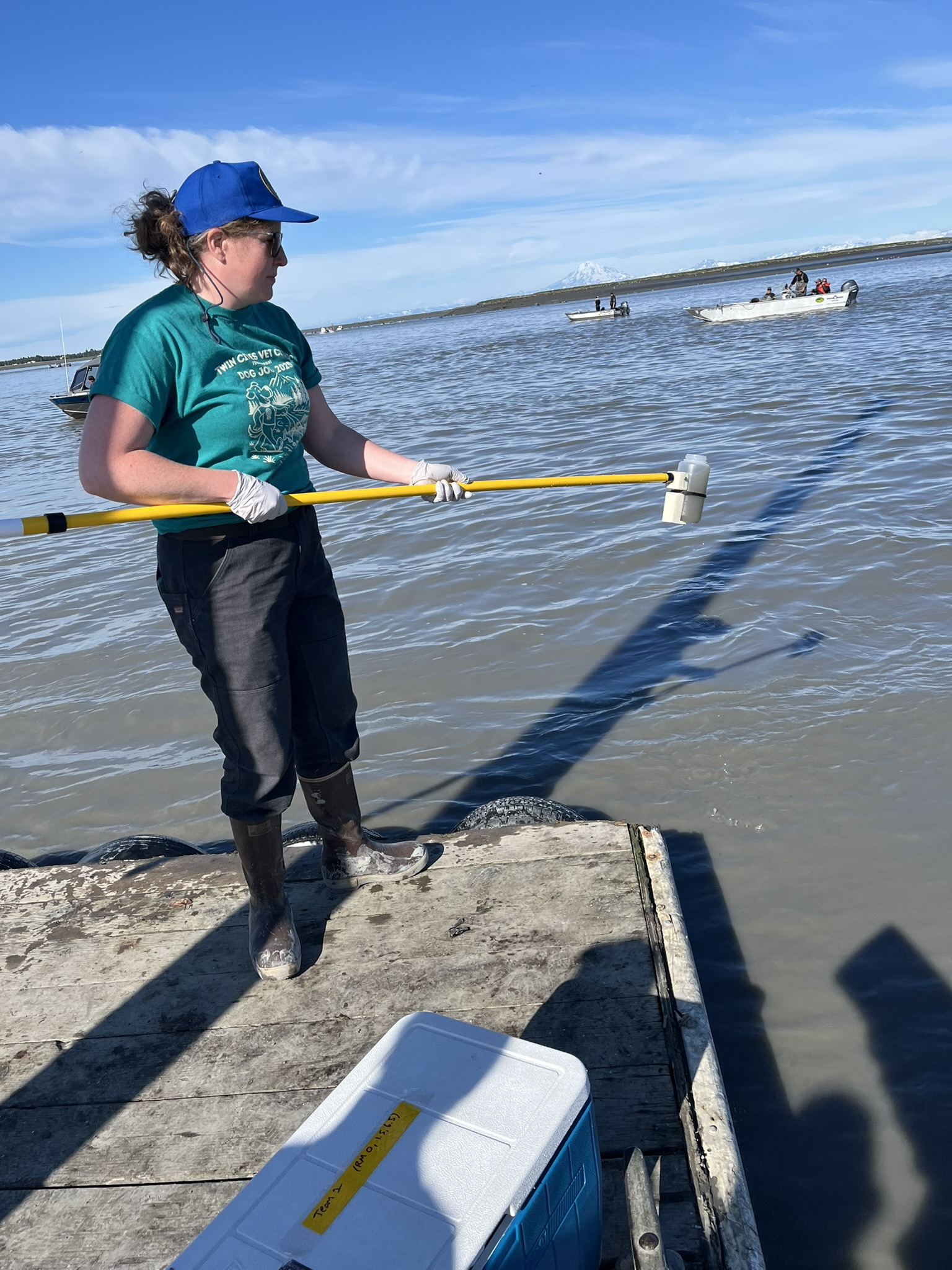
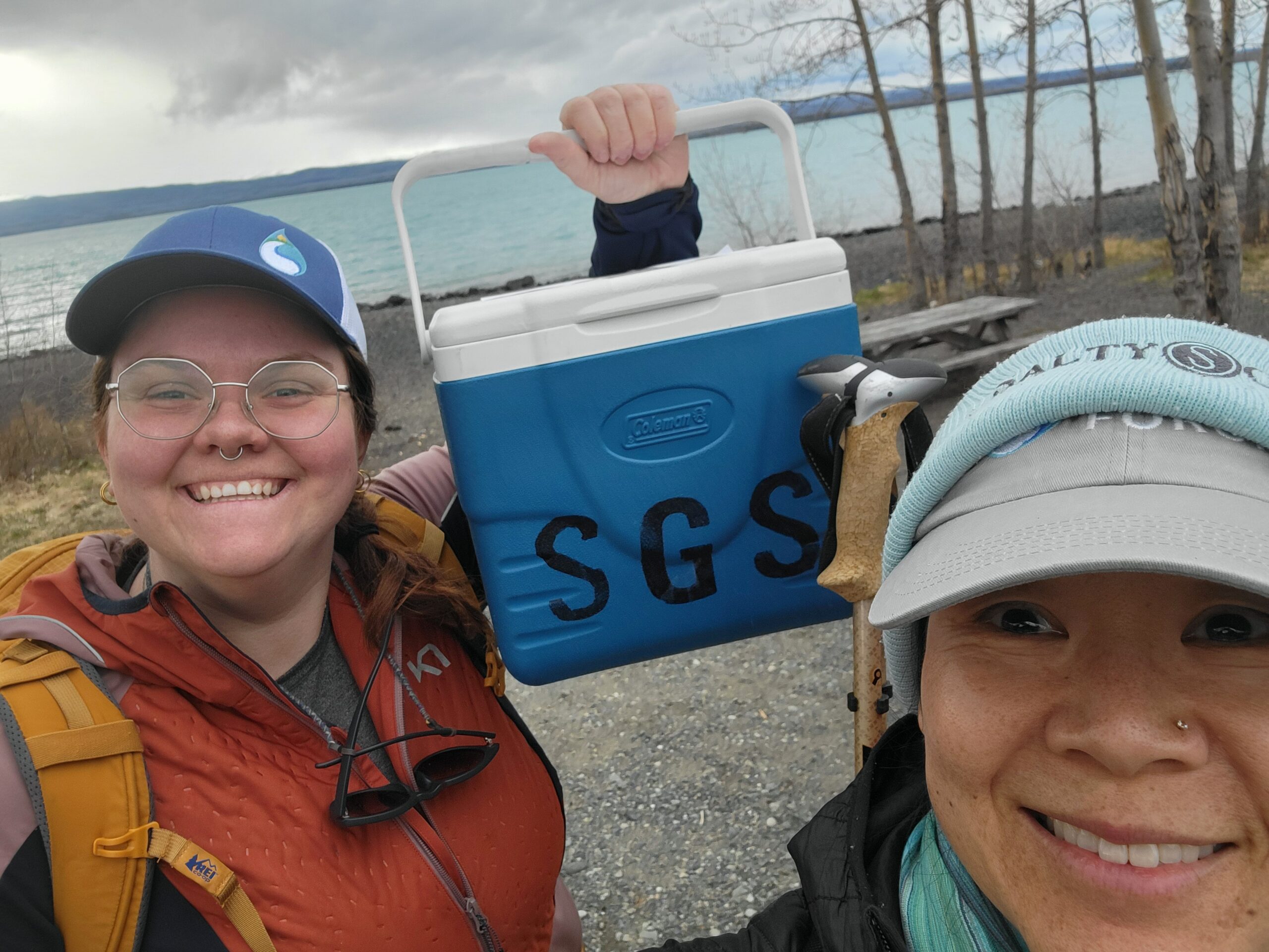
Summer 2025 Kenai River Water Quality Monitoring Data – Preliminary Results Available
January 2, 2026Kenai Watershed Forum has received all laboratory results from it’s Summer 2025 Baseline Water Quality Monitoring. The results are currently being prepared for upload to the Environmental Protection Agency’s Water Quality Exchange, a public data repository for water quality data.
Once the data is prepared, it will be integrated into an in-progress comprehensive summary report, similar to our previous such report published in 2016.
The results are preliminary and have not yet been subject to QA/QC checks or analyzed against water quality standards; this work is in progress.
We worked with two laboratories in Summer 2025:
1.) Soldotna Wastewater Treatment Plant – SWWTP provided analyses of Total Suspended Solids and Fecal Coliform:
Download Summer 2025 Total Suspended Solids results (in progress)
Download Summer 2025 Fecal Coliform results
2.) SGS Laboratories, Anchorage – SGS provided analyses of all other substances monitored in Spring 2025, including nutrients like phosphorus and nitrogen, and metals like zinc, copper, lead, and others:
Download Summer 2025 Metals and Nutrients results
We are extremely grateful to both the City of Soldotna for and SGS Laboratories for providing in-kind services that support this important work!
For questions about 2025 water quality results, contact Benjamin Meyer, Water Quality Coordinator. Thank you again to all the participants and volunteers who made this event happen!
To learn more about this project, visit our website section.
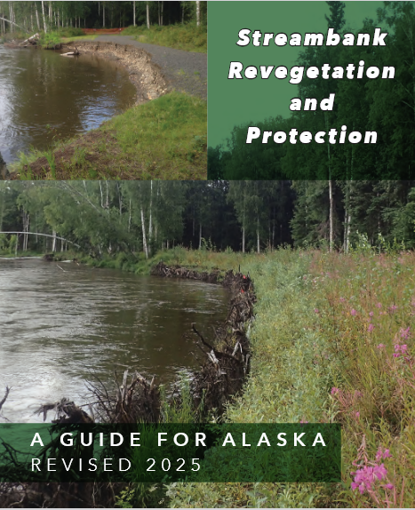
The New 2025 Alaska Streambank Revegetation and Protection Guide is Now Available!
December 17, 2025The new and improved guide to restoring and protecting Alaskan streambanks is now available for free! Download yours here.
Riverbank plants, trees, and shrubs (also known as “riparian vegetation”) play an outsized role in keeping habitat healthy for salmon and other freshwater fish. Riparian vegetation helps prevent bankside erosion, provides shade to help keep waters cool, and provides a source of insects as food for young fish, among many other benefits. When riparian vegetation is damaged or removed, it can take decades to recover.
Riparian vegetation can also be restored using bio-engineering and construction techniques that allow it to grow and change with the river’s natural course. Long gone are the days when riverside property owners were recommended to use old cars, tires, or concrete to stabilize their shoreline on the Kenai Peninsula’s rivers and lakes. Today’s restoration projects use techniques that mimic the best of what nature has to offer like cabling spruce trees to shorelines, planting willows, and installing spruce tree root wads.
Do you know of or own a streambank that could use some love? Let us know, or consider applying for the Cost Share Program, which may cover up to 50% of restoration expenses.
Read more about Kenai Watershed Forum’s streambank restoration work here.
Let’s work together to keep the Kenai Peninsula streambanks healthy!

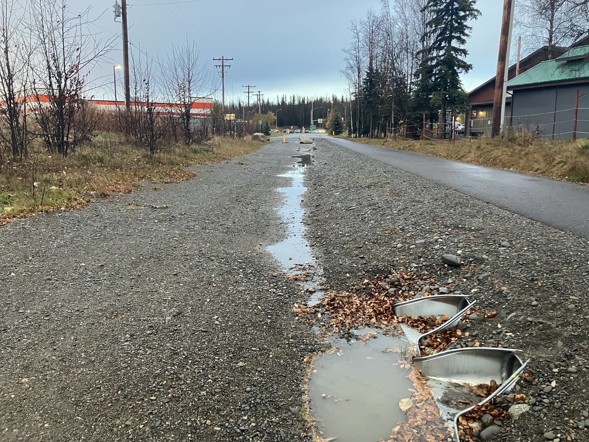
Then & Now: Impervious Surface Growth and Stormwater Runoff on the Lower Kenai River
December 9, 2025Above: stormwater runoff from impervious surfaces flows towards two small culverts in Soldotna, Fall 2025
Between 1980 to 2021, population in the Kenai Peninsula Borough more than doubled, growing by more than 130% from approximately 25,000 residents to approximately 60,000 residents. With the influx of people moving to the Kenai Peninsula, total area in the lower Kenai River covered by impervious surfaces including roads, roofs, and cleared lots increased by 22% in that same time frame. With the increase in impervious surfaces, the potential for untreated stormwater runoff increases, threatening water quality of the rivers, lakes, ponds and other natural resources.
Kenai Watershed Forum’s office regularly receives calls from concerned local citizens about stormwater pollutants including road salts, tire particles, and others. Is this something we should be worried about in the Kenai River and its tributaries? And do we have data to know? The respective answers are yes and no. Yes, we should be concerned, because nearly all riverside communities throughout history experience stormwater runoff issues as they grow in size and population; and no, there is currently no comprehensive, annual monitoring program that specifically targets stormwater runoff in the Kenai River. While the Kenai River Baseline Comprehensive Water Quality Monitoring program monitors water quality biannually throughout the Kenai River, and the city wastewater treatment plants of Kenai and Soldotna also monitor their treated waters, none of these efforts are structured to specifically study stormwater runoff or assess its sources.
The good news is, several projects funded by the Kenai Peninsula Fish Habitat Partnership are tackling this challenge.
In 2021 Kenai Watershed Forum worked with St. Mary’s University of Minnesota Geospatial Services (SMU GSS) to map and understand changes in impervious surfaces in the areas surrounding the cities of Kenai and Soldotna. SMU GSS used an innovative semi-automated approach to identify and map impervious surfaces, and calculated summary statistics. In addition to the 22% overall increase in impervious surfaces mentioned above, other highlights include a 100% increase in roof areas, and a 3% increase in total paved road areas. This is a rich dataset that researchers can use to address many future questions, and final report is available here.
In 2024 SMU GSS followed up with a pilot project to identify local “stormwater hotspots.” Using the impervious surfaces layers from the previous project, they explored feasibility of using GIS analysis to pinpoint specific locations where stormwater runoff accumulated to specific pour points. With knowledge of these locations, we can begin to recommend solutions, such as settling ponds, bioswales, or other “green stormwater infrastructure” solutions to intercept this runoff. The report (available here) highlighted a few critical missing elements of local datasets and recommendations for researchers and managers going forward.
In 2025, Kenaitze Indian Tribe was awarded a grant to expand local surface water quality monitoring efforts. Following feedback from the tribal environmental council, Kenaitze will be working with Kenai Watershed Forum to assess water quality in new locations and addressing new parameters. The grant also supports collaboration with Kenaitze summer interns, who will be gain field experience and mentoring. This work will kick off in spring 2026, and we can’t wait to see what we can learn.
Sign up for our newsletter to follow us on this project, or sign up as a Stream Watch volunteer to learn how you can get involved!
– Benjamin Meyer, Research Coordinator
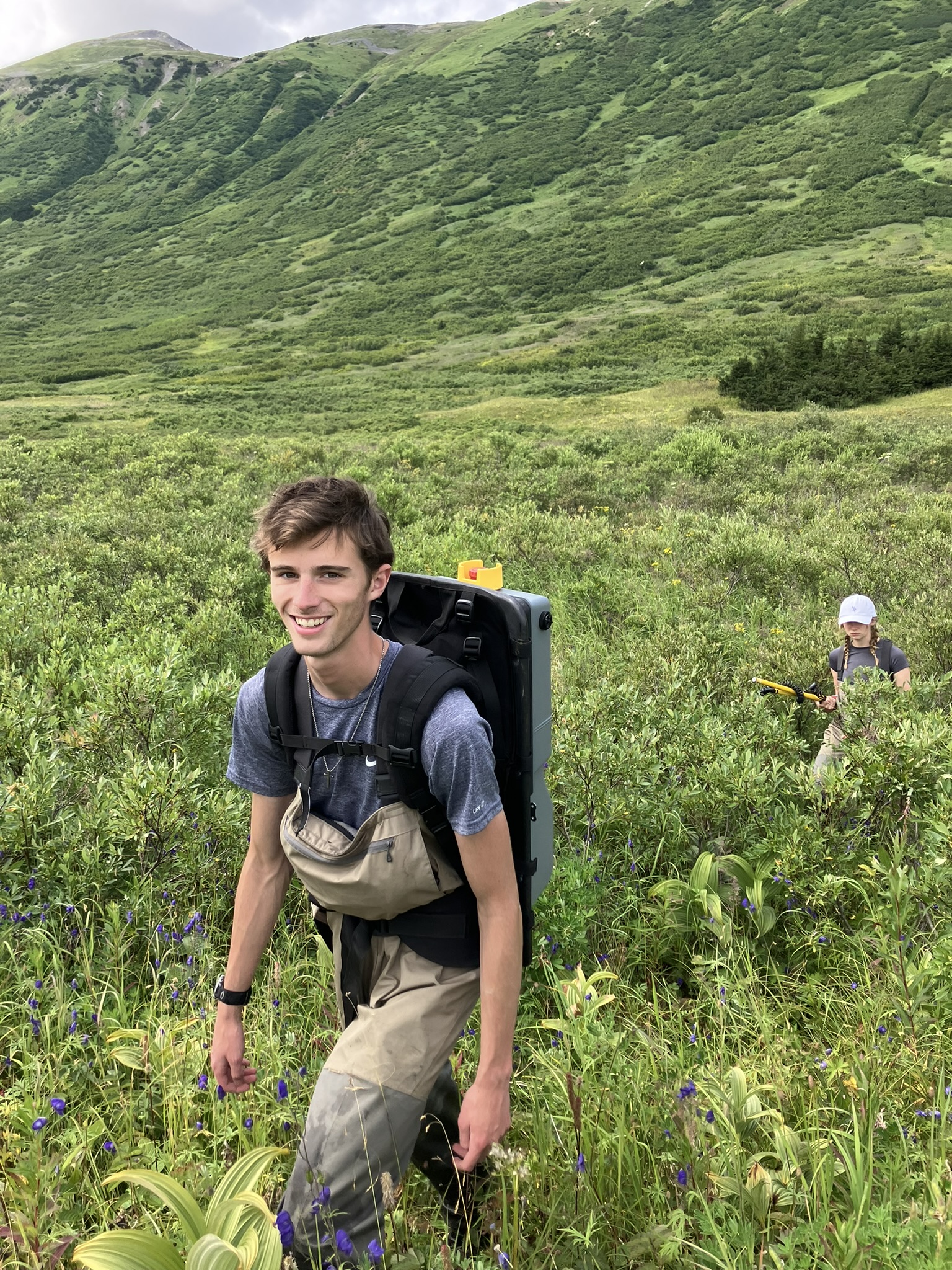
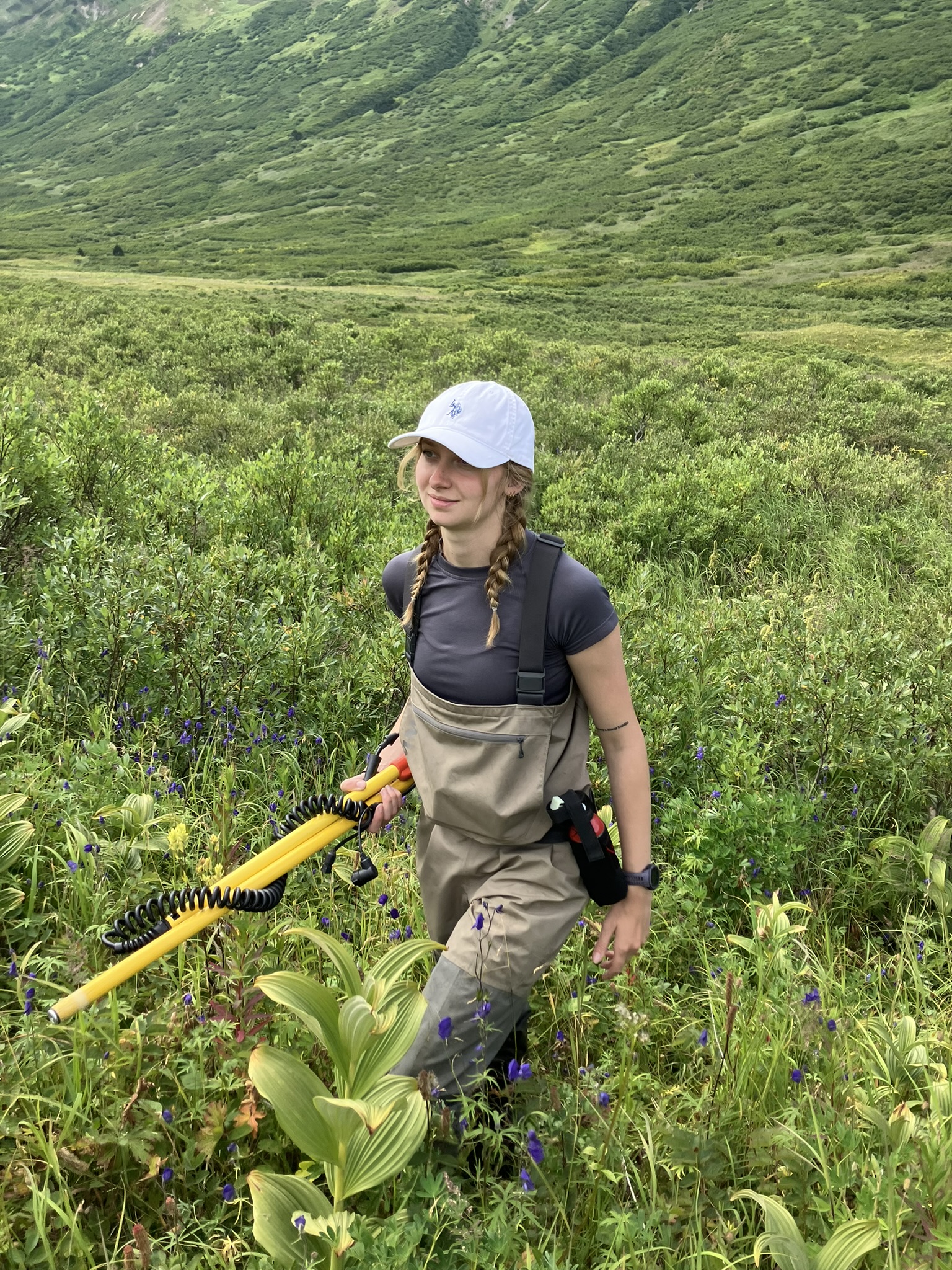
Launching a new initiative to map salmon habitat across the Kenai Peninsula Borough
September 5, 2025Above: KWF staff use a backpack electrofisher to survey fish habitat in Turnagain Pass, Alaska
Since the early days of Kenai Watershed Forum, we have worked to improve maps of local fish habitat. Good maps are a critical tool for responsible habitat management – we can only hope to have wild fish around for the future if we know where they live today.
Our work has focused on the Anadromous Waters Catalog, which is the Alaska Department of Fish and Game’s inventory of documented waterbodies used by migratory freshwater fish species. Salmon are the most well-known of local “anadromous” fish (i.e., they migrate between freshwater and the ocean), but other important species such as lamprey, steelhead, and others also rely on free-flowing routes between the ocean and their spawning and rearing habitats.
In the Kenai Peninsula Borough, over 4800 miles of streams and rivers are listed as anadromous habitat as of year 2025. Documenting these habitats is a critical conservation and management tool, as documented anadromous habitats can trigger decisions that help maintain healthy habitat to support wild fish populations (such as installing fish-friendly culverts). However when these habitats remain undocumented, they risk oversight and potential damage as communities grow and develop.
In the Kenai region as well as statewide, the challenge of mapping and documenting anadromous habitat is enormous. Staff with the Alaska Department of Fish and Game and other organizations typically identify hundreds of new miles of undocumented habitat each year throughout the state (read more about these efforts here, here, and here). From 2021 – 2024, efforts by Kenai Watershed Forum in partnership with volunteers from the Kenai Peninsula Chapter of Trout Unlimited documented dozens of miles of local streams and lakes right under our noses. While these additions are achievements both for agencies and volunteer efforts, we estimate that still less than 40% of likely anadromous waters throughout the Kenai Peninsula Borough are currently inventoried. The work ahead remains enormous, and without better maps, large swaths of wild fish habitat remain in some senses “invisible”.
But what if there was another way? It turns out, there might be.
While sunny days outdoors working to discover previously-unseen wild fish habitat in our backyards is a great joy for a biologist, replicating that work at the scale of the entire Kenai Peninsula Borough would require countless trips by boat, helicopter, plane, and vehicle, just to arrive at the start of more all-day bushwhacks to survey for anadromous fish. Even then, it’s likely that much habitat would remain unmapped, as our eyes are not always the best judge of the many surprising nooks and crannies where fish can be found across the landscape.
After years of trudging through hip-deep swamps and slogging up mountainsides to look for fish, we started looking in to how researchers in other parts of the country have tackled this kind of challenge. We stumbled across work in progress by the Hoonah Native Forest Partnership in southeast Alaska. There, scientists and community members are working together to develop maps that predict where wild fish habitat is yet to be documented. Using a combination of fieldwork, aerial imagery, and cutting-edge research, they have produced maps that predict fish presence/absence with >98% accuracy within an average of ± 200ft. (Read more about fish habitat mapping in southeast Alaska here).
While scientists have previously used predictive maps to help understand the extent of freshwater fish habitat in Alaska, typically the goal of these efforts is simply to assist in guiding fieldwork efforts. These maps are generally much less accurate than the approach developed by the Hoonah Native Forest Partnership, as they are based on remotely-sensed features of the landscape (such as waterfalls or steep rapids) that may or may not reliably predict fish presence/absence.
With the possibility of reliable predictive maps, the goal advances beyond simply prioritizing fieldwork: we can begin to understand and manage aquatic habitat at the scale of whole landscapes, rather than simply what we’re able to access on foot or see with our eyes.
In spring 2025, Kenai Watershed Forum was awarded a federal grant from the National Coastal Resilience Fund to explore if these habitat modeling approaches proven successful in southeast Alaska can be adapted to southcentral Alaska. We are excited to add a host of new partners in addition to all those already mentioned: consultants Romey Riverscape Sciences and Terrainworks, consultants who are providing the technical expertise to help draft these maps and much more. Also, we are privileged to be a part of local nonprofit Cook Inletkeeper’s Local Solutions program, which is bringing community members into the fold for hands-on opportunities to be a part of this work.
Will it be possible to predict presence/absence of anadromous fish with high accuracy for the Kenai Peninsula Borough region? We don’t know yet. We’re just beginning the research process this year and can’t wait to know more. There will always be a trade-off between a map’s accuracy and the expense it took to produce it. The more high-quality data we have, the better our maps will be, and the better opportunity managers will have to balance the needs of fish habitat and developing communities.
We’re off to the races in new and interesting frontiers of science and community collaboration. Subscribe to our newsletter and Cook Inletkeeper’s newsletter to stay informed about volunteer opportunities and more!
In addition to our new support from the National Coastal Resilience Fund, this work would not possible without previous financial support from the Alaska Sustainable Salmon Fund project #54014, Trout Unlimited’s Embrace-a-Stream grant program, the Kenai Peninsula Chapter of Trout Unlimited, and the Kenai Community Foundation. Thank you!
Click Here for Further Reading: Kenai Watershed Forum Works with Volunteers to Document 22.4 miles of Local Salmon Habitat
— Benjamin Meyer, Research Coordinator
Sam Trussell (Summer 2025)
September 4, 2025By the time I landed in Kenai, I still didn’t really know what I was getting myself into out here. I had applied for the internship simply because I thought 3 months in Alaska sounded awesome, (which it is) not really considering the scope and impact of my position with the KWF. All I had hoped was that the job would be exciting, and that standard was exceeded immediately. Before I knew it I was chest-deep in glacial rivers building fencing, learning to drive ATVs and trailers, and spotting black bears on the Russian river.
As much fun as I had at work, my favorite moments this summer were on my personal time, mostly because of the vehicles the KWF provided. All the staff know I was getting out adventuring all the time, including my 4 attempts to finish the Harding Icefield hike in the Kenai Fjords in early summer. My project for the summer was to get up to the top as soon as possible. My first time the snow was way too deep and I lost the trail very quickly. On the second attempt weather and visibility became an issue towards the end, and I once again turned around. On my 3rd attempt all was going well until I saw a rock slide coming down the slope next to me. It went off at an angle that didn’t get to me, but that shook me enough to call it a day. But I was determined to finish this, so I went back one July evening and finally pushed all the way through. Standing above that icefield I felt as though I was on another planet, it was unlike anything I’d ever experienced.
Through my countless other adventures this summer on and off duty I’ve constantly encountered the feeling of otherworldliness, and I dare anybody with the opportunity to come here to do whatever it takes to get out here, it really is beyond the scope of the rest of the world.
Lola Schwinghamer (Summer 2025)
September 4, 2025In my summer as an intern at KWF, I have learned so much-not only about the environments around us but also about myself. When I first arrived, I didn’t have a clear idea of what I was doing; I just knew it was going to be mad cool. And honestly, it exceeded all my expectations. The people at KWF are amazing, they genuinely care about you beyond the role of the intern, which makes all the difference.
I had the privilege of working with Ben for most of the summer on various fish habitat projects. The work ranged from setting out minnow traps to wading in water with electrofishing gear. I quickly learned that a healthy habitat for fish is way more complicated than just clear water. It’s about the right temperature, flow, pH levels, and many more aspects. I also spent some time working on invasive plant surveys and treatments with Homer Soil and Water Conservation District. Lots of bird vetch and orange hawkweed to pull and deadhead. My contempt for those plants spread almost as fast as they did. By the end of the summer, I had grown a deep appreciation for just how much effort goes into maintaining a balanced and healthy ecosystem.
I am truly grateful that I was a part of this dedicated and motivated team. They made work not feel like ”work” and were always willing to put up with any strange question I asked. This internship will always be one of my favorite memories to share. Thank you KWF for everything.
Spring 2025 Kenai River Water Quality Monitoring – Preliminary Results Available
June 20, 2025Kenai Watershed Forum has received all laboratory results from it’s Spring 2025 Baseline Water Quality Monitoring. The results are currently being prepared for upload to the Environmental Protection Agency’s Water Quality Exchange, a public data repository for water quality data.
Once the data is prepared, it will be integrated into an in-progress comprehensive summary report, similar to our previous such report published in 2016.
The results are preliminary and have not yet been subject to QA/QC checks or analyzed against water quality standards; this work is in progress.
We worked with two laboratories in Spring 2025:
1.) Soldotna Wastewater Treatment Plant – SWWTP provided analyses of Total Suspended Solids and Fecal Coliform:
Download Spring 2025 Total Suspended Solids results
Download Spring 2025 Fecal Coliform results
2.) SGS Laboratories, Anchorage – SGS provided analyses of all other substances monitored in Spring 2025, including nutrients like phosphorus and nitrogen, and metals like zinc, copper, lead, and others:
Download Spring 2025 Metals and Nutrients results
We are extremely grateful to both the City of Soldotna for and SGS Laboratories for providing in-kind services that support this important work!
For questions about 2025 water quality results, contact Benjamin Meyer, Water Quality Coordinator. Thank you again to all the participants and volunteers who made this event happen!
To learn more about this project, visit our website section.
