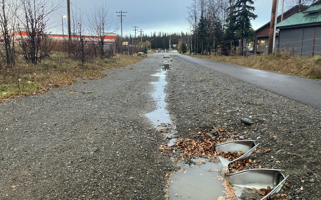
Above: stormwater runoff from impervious surfaces flows towards two small culverts in Soldotna, Fall 2025
Between 1980 to 2021, population in the Kenai Peninsula Borough more than doubled, growing by more than 130% from approximately 25,000 residents to approximately 60,000 residents. With the influx of people moving to the Kenai Peninsula, total area in the lower Kenai River covered by impervious surfaces including roads, roofs, and cleared lots increased by 22% in that same time frame. With the increase in impervious surfaces, the potential for untreated stormwater runoff increases, threatening water quality of the rivers, lakes, ponds and other natural resources.
Kenai Watershed Forum’s office regularly receives calls from concerned local citizens about stormwater pollutants including road salts, tire particles, and others. Is this something we should be worried about in the Kenai River and its tributaries? And do we have data to know? The respective answers are yes and no. Yes, we should be concerned, because nearly all riverside communities throughout history experience stormwater runoff issues as they grow in size and population; and no, there is currently no comprehensive, annual monitoring program that specifically targets stormwater runoff in the Kenai River. While the Kenai River Baseline Comprehensive Water Quality Monitoring program monitors water quality biannually throughout the Kenai River, and the city wastewater treatment plants of Kenai and Soldotna also monitor their treated waters, none of these efforts are structured to specifically study stormwater runoff or assess its sources.
The good news is, several projects funded by the Kenai Peninsula Fish Habitat Partnership are tackling this challenge.
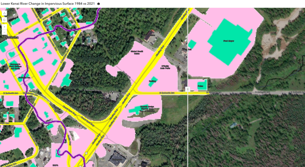
In 2021 Kenai Watershed Forum worked with St. Mary’s University of Minnesota Geospatial Services (SMU GSS) to map and understand changes in impervious surfaces in the areas surrounding the cities of Kenai and Soldotna. SMU GSS used an innovative semi-automated approach to identify and map impervious surfaces, and calculated summary statistics. In addition to the 22% overall increase in impervious surfaces mentioned above, other highlights include a 100% increase in roof areas, and a 3% increase in total paved road areas. This is a rich dataset that researchers can use to address many future questions, and final report is available here.
In 2024 SMU GSS followed up with a pilot project to identify local “stormwater hotspots.” Using the impervious surfaces layers from the previous project, they explored feasibility of using GIS analysis to pinpoint specific locations where stormwater runoff accumulated to specific pour points. With knowledge of these locations, we can begin to recommend solutions, such as settling ponds, bioswales, or other “green stormwater infrastructure” solutions to intercept this runoff. The report (available here) highlighted a few critical missing elements of local datasets and recommendations for researchers and managers going forward.
In 2025, Kenaitze Indian Tribe was awarded a grant to expand local surface water quality monitoring efforts. Following feedback from the tribal environmental council, Kenaitze will be working with Kenai Watershed Forum to assess water quality in new locations and addressing new parameters. The grant also supports collaboration with Kenaitze summer interns, who will be gain field experience and mentoring. This work will kick off in spring 2026, and we can’t wait to see what we can learn.
Sign up for our newsletter to follow us on this project, or sign up as a Stream Watch volunteer to learn how you can get involved!
– Benjamin Meyer, Research Coordinator
